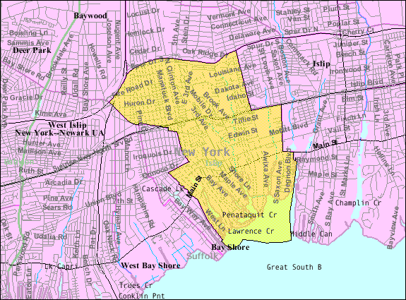
ملف:Bay-shore-map.png
Bay-shore-map.png (575 × 425 بكسل حجم الفايل: 76 كيلوبايت، نوع MIME: image/png)
تاريخ الفايل
اضغط على الساعه/التاريخ علشان تشوف الفايل زى ما كان فى الوقت ده.
| الساعه / التاريخ | صورة صغيرة | ابعاد | يوزر | تعليق | |
|---|---|---|---|---|---|
| دلوقتي | 22:33، 23 اغسطس 2014 |  | 575 × 425 (76 كيلوبايت) | GifTagger | Bot: Converting file to superior PNG file. (Source: Bay-shore-map.gif). This GIF was problematic due to non-greyscale color table. |
استخدام الفايل
ال1 صفحة دى فيها وصله للفايل ده:
استخدام الملف العام
الويكيات التانيه دى بتستخدم الفايل ده:
- الاستخدام ف ar.wikipedia.org
- الاستخدام ف azb.wikipedia.org
- الاستخدام ف ca.wikipedia.org
- الاستخدام ف en.wikipedia.org
- الاستخدام ف es.wikipedia.org
- الاستخدام ف eu.wikipedia.org
- الاستخدام ف fa.wikipedia.org
- الاستخدام ف fr.wikipedia.org
- الاستخدام ف sh.wikipedia.org
- الاستخدام ف sr.wikipedia.org
- الاستخدام ف tt.wikipedia.org
- الاستخدام ف vo.wikipedia.org
- الاستخدام ف www.wikidata.org


