ملف:Islip-town-map.gif
مافيش ريزوليوشن اعلى متوفر.
Islip-town-map.gif (575 × 425 بكسل حجم الفايل: 48 كيلوبايت، نوع MIME: image/gif)
الخلاصة

|
نُقِل هذا الملف إلى ويكيميديا كُومُنز من en.wikipedia باستعمال بوتٍ نقلَ بيانات المصدر كاملةً، لكنَّها تتطلب مراجعةً. بالإضافة لذلك، قد توجد أخطاء في بعض حقوق المعلومات، لذا فإنَّ معلومات هذا الملفِّ غير مَوثُوقة ولا ينصح باستعماله حتَّى يُراجع أولاً لتصحيح أي معلومات خاطئة في بياناته. يُزال هذا القالب عندما تكتمل المراجعة، للمزيد من المعلومات حول هذا الملف: اضغط هنا. |
| وصف | |
| تاريخ | |
| مصدر | http://factfinder.census.gov |
| مؤلف | United States Census Bureau |
| سماح (إعادة استخدام الملف ده) |
Public domain |
الترخيص
This image or file is a work of a United States Census Bureau employee, taken or made as part of that person's official duties. As a work of the U.S. federal government, the image is in the public domain.
|
 |
سجلُّ الرَّفع الأصيل
Transferred from en.wikipedia to Commons by Milicevic01 using CommonsHelper.
The original description page was here. All following user names refer to en.wikipedia.
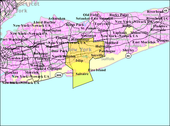
- 2007-10-22 23:38 Americasroof 575×425× (48766 bytes) [[Islip, New York]] town map from U.S. Census
تاريخ الفايل
اضغط على الساعه/التاريخ علشان تشوف الفايل زى ما كان فى الوقت ده.
| الساعه / التاريخ | صورة صغيرة | ابعاد | يوزر | تعليق | |
|---|---|---|---|---|---|
| دلوقتي | 10:56، 22 اغسطس 2013 | | 575 × 425 (48 كيلوبايت) | File Upload Bot (Magnus Manske) | Transfered from en.wikipedia by User:Milicevic01 using CommonsHelper |
| 10:55، 22 اغسطس 2013 |  | 575 × 425 (48 كيلوبايت) | File Upload Bot (Magnus Manske) | Transfered from en.wikipedia by User:Milicevic01 using CommonsHelper |
استخدام الفايل
ال1 صفحة دى فيها وصله للفايل ده:
استخدام الملف العام
الويكيات التانيه دى بتستخدم الفايل ده:
- الاستخدام ف ar.wikipedia.org
- الاستخدام ف de.wikipedia.org
- الاستخدام ف en.wikipedia.org
- الاستخدام ف es.wikipedia.org
- الاستخدام ف fr.wikipedia.org
- الاستخدام ف ht.wikipedia.org
- الاستخدام ف nl.wikipedia.org
- الاستخدام ف pnb.wikipedia.org
- الاستخدام ف sh.wikipedia.org
- الاستخدام ف sr.wikipedia.org
- الاستخدام ف sv.wikipedia.org
- الاستخدام ف tt.wikipedia.org
- الاستخدام ف ur.wikipedia.org
- الاستخدام ف www.wikidata.org