ملف:USACE Amory Lock.jpg

حجم البروفه دى: 800 × 559 بكسل. الأبعاد التانيه: 320 × 224 بكسل | 640 × 448 بكسل | 1,024 × 716 بكسل | 1,280 × 895 بكسل | 1,500 × 1,049 بكسل.
الصوره الاصليه (1,500 × 1,049 بكسل حجم الفايل: 425 كيلوبايت، نوع MIME: image/jpeg)
| وصف |
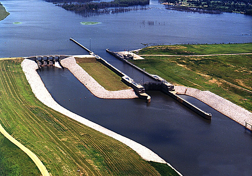
English: Amory Lock, formerly called Lock A, on the Tennessee-Tombigbee Waterway, Amory, Mississippi, USA. View is upriver to the northeast. |
|||
| تاريخ | not specified | |||
| مصدر |
U.S. Army Corp of Engineers Digital Visual Library Digital Visual Library home page Image page Image description page |
|||
| مؤلف | Adrien Lamarre, U.S. Army Corps of Engineers | |||
| سماح (إعادة استخدام الملف ده) |
|
| موقع آلة التصوير | | هذه وغيرها من الصور في مواقعها على: خريطة الشارع المفتوحة |
|---|
تاريخ الفايل
اضغط على الساعه/التاريخ علشان تشوف الفايل زى ما كان فى الوقت ده.
| الساعه / التاريخ | صورة صغيرة | ابعاد | يوزر | تعليق | |
|---|---|---|---|---|---|
| دلوقتي | 04:11، 14 مارس 2007 | | 1,500 × 1,049 (425 كيلوبايت) | DanMS | {{Information | Description = Amory Lock, formerly called Lock A, on the Tennessee-Tombigbee Waterway, Amory, Mississippi, USA. | Source = U.S. Army Corp of Engineers Digital Visual Library<br />[http://images.usace.army.mil/Main.html Digital Visual |
استخدام الفايل
ال1 صفحة دى فيها وصله للفايل ده:
استخدام الملف العام
الويكيات التانيه دى بتستخدم الفايل ده:
- الاستخدام ف en.wikipedia.org