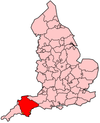
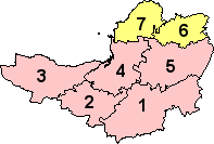
قالب:Infobox England county/doc
| This is a documentation subpage for قالب:Infobox England county It may contain usage information, categories and other content that is not part of the original قالب page. |
Usage
تعديلCopy and paste the code below into the article, then add the appropriate values to the fields. Comments (<!-- in these blocks -->) can be removed from the final code.
| Name of county | |
|---|---|
| Image (e.g. flag) - OPTIONAL | |
| Motto of county council: Motto in original language followed by (Name of language: translation into English) - OPTIONAL | |

| |
| Geography | |
| Status | Status (ceremonial? administrative?) |
| Origin | Year of establishment (e.g. West Midlands = 1974) |
| Region | Government Office Region |
| Area - Total - Admin. council - Admin. area |
Ranked 4th 1,000 كـم2 (390 ميل2) Ranked 5th - OPTIONAL 950 كـم2 (370 ميل2) |
| Admin HQ | Wibbleton (not required if not an admin. county) - OPTIONAL |
| ISO 3166-2 | ISO 3166-2 code - OPTIONAL |
| ONS code | ONS code |
| NUTS 3 | NUTS 2/3 code |
| Demography | |
| Population - Total (2004) - Density - Admin. council - Admin. pop. |
Ranked 4th 1,000,000 254/كم2 (660/ميل2) Ranked 5th - OPTIONAL 950,000 |
| Ethnicity | xx% White yy% Afro-Carib. zz% S. Asian |
| Politics | |
| The name http://www.and-website.gov.uk/ REMOVE THIS LINE FOR No county council | |
| Executive | |
| Members of Parliament |
|
| Remove this line for "Districts"; otherwise enter alternative name ("Metropolitan boroughs", etc.) | |

| |
{{Infobox England county
 | name =
 | image = <!-- Flag, etc. -- OPTIONAL -->
 | motto = <!-- OPTIONAL -->
 | map =
 | status =
 | origin = <!-- (year of establishment for "new" counties) OPTIONAL -->
 | region =
 | arearank =
 | area_km2 = <!--RAW Format only, no commas-->
 | adminarearank = <!-- OPTIONAL, REMOVE LINE IF NOT NEEDED -->
 | adminarea_km2 = <!-- RAW Format only, OPTIONAL, REMOVE LINE IF NOT NEEDED -->
 | adminhq = <!-- OPTIONAL, REMOVE LINE IF NOT NEEDED -->
 | iso = <!-- OPTIONAL -->
 | ons =
 | nutscode = <!-- NUTS x - (x = value entered, or leave blank for NUTS 3) - OPTIONAL -->
 | nuts3 =
 | poprank =
 | popestdate =
 | pop =
 | density_km2 = <!--RAW Format only, no commas-->
 | adminpoprank = <!-- OPTIONAL, REMOVE LINE IF NOT NEEDED -->
 | adminpop = <!-- OPTIONAL, REMOVE LINE IF NOT NEEDED -->
 | ethnicity =
 | council = <!-- Default value: No county council -- REMOVE LINE IF NOT NEEDED -->
 | mps =
 | subdivname = <!-- Default value: Districts -- REMOVE LINE IF NOT NEEDED -->
 | subdivmap =
 | subdivs =
}}
Microformat
تعديلThe HTML mark up produced by this template includes an hCard microformat, which makes the place-name and location parsable by computers, either acting automatically to catalogue article across Wikipedia, or via a browser tool operated by a person, to (for example) add the subject to an address book. For more information about the use of microformats on Wikipedia, please see the microformat project.
If the place or venue has an "established", "founded", "opened" or similar date, specific to the day, use {{start date}} (unless the date is before 1583 CE); if it has a URL, use {{URL}}.
hCard uses HTML classes including:
- adr
- category
- country-name
- extended-address
- fn
- label
- locality
- nickname
- note
- org
- street-address
- url
- vcard
Please do not rename or remove these classes; nor collapse nested elements which use them.