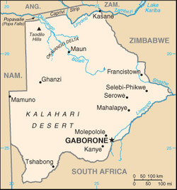
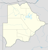
قالب:Location map Botswana/doc
| هذه صفحة توثيق الفرعية، لشرح القالب وتصنيفه، وهي لا تدخل في استخدامه. |

Template:Location map Botswana is a location map definition used to overlay markers and labels on an equirectangular projection map of Botswana. The markers are placed by latitude and longitude coordinates on the default map or a similar map image.
Usage
تعديلThese definitions are used by the following templates when invoked with parameter "Botswana":
{{Location map | Botswana | ...}}{{Location map many | Botswana | ...}}{{Location map+ | Botswana | ...}}{{Location map~ | Botswana | ...}}
Map definition
تعديل- name = Botswana
- Name used in the default map caption
- image = Botswana location map.svg
- The default map image, without "Image:" or "File:"
- image1 = Botswana physical map.svg
- An alternative map image, usually a relief map, can be displayed via the relief or AlternativeMap parameters
- top = -17.3
- Latitude at top edge of map, in decimal degrees
- bottom = -27.5
- Latitude at bottom edge of map, in decimal degrees
- left = 19.4
- Longitude at left edge of map, in decimal degrees
- right = 29.7
- Longitude at right edge of map, in decimal degrees
Alternative map
تعديلThe map defined as image1 (Botswana physical map.svg) can be displayed by using the relief or AlternativeMap parameters in {{Location map}}, {{Location map many}} and {{Location map+}}. The use of these two parameters is shown in the examples below. Additional examples can be found at:
Examples using location map templates
تعديلLocation map, using default map (image)
تعديل{{Location map | Botswana
| width = 200
| label = Gaborone
| lat_deg = -24.66
| lon_deg = 25.91
}}
Location map many, using relief map (image1)
تعديلخطأ لوا في وحدة:تحويلات_بلدان/map على السطر 3: assign to undeclared variable 'getmmm'.
{{Location map many | Botswana
| relief   = yes
| width    = 200
| caption  = Two locations in Botswana
| label1   = Gaborone
| lat1_deg = -24.66
| lon1_deg = 25.91
| label2   = Francistown
| lat2_deg = -21.17
| lon2_deg = 27.51
}}
Location map+, using AlternativeMap
تعديلخطأ لوا في وحدة:تحويلات_بلدان/map على السطر 3: assign to undeclared variable 'getmmm'.
{{Location map+ | Botswana
| AlternativeMap = Botswana physical map.svg
| width   = 200
| caption = Two locations in Botswana
| places  =
  {{Location map~ | Botswana
  | label   = Gaborone
  | lat_deg = -24.66
  | lon_deg = 25.91
  }}
  {{Location map~ | Botswana
  | label   = Francistown
  | lat_deg = -21.17
  | lon_deg = 27.51
  }}
}}
See also
تعديل- Location map templates
- Template:Location map, to display one mark and label using latitude and longitude
- قالب:Location map many, to display up to nine marks and labels
- قالب:Location map+, to display an unlimited number of marks and labels
- Infobox templates incorporating (passing values to) the Location map template
- قالب:معلومات مطار — alternative map support: relief (via pushpin_relief) and AlternativeMap (via pushpin_image)
- قالب:معلومات موقع أثري قديم — alternative map support: relief
- قالب:معلومات عمل فني
- قالب:صندوق معلومات مبنى — alternative map support: relief
- قالب:صندوق معلومات كازينو
- قالب:Infobox castrum — alternative map support: relief (via map_relief)
- قالب:معلومات كهف (via Infobox map) — alternative map support: relief
- قالب:ص.م مقبرة
- قالب:خلاف مدني
- قالب:Infobox climbing route (via Infobox map) — alternative map support: relief
- قالب:معلومات كنسية — alternative map support: relief
- قالب:Infobox concentration camp
- قالب:ص.م سد — alternative map support: relief
- قالب:Infobox dava
- قالب:معلومات غابة (via Infobox map) — alternative map support: relief
- قالب:Infobox glacier (via Infobox map) — alternative map support: relief (displays relief image unless map_relief=0)
- قالب:Infobox golf facility — alternative map support: relief
- قالب:صندوق معلومات موقع تاريخي — alternative map support: relief (via map_relief)
- قالب:معلومات مستشفى — alternative map support: relief
- قالب:Infobox hut — alternative map support: relief
- قالب:صندوق معلومات منارة — alternative map support: relief
- قالب:معلومات خريطة (used by other infoboxes) — alternative map support: relief
- قالب:معلومات نزاع عسكري — alternative map support: relief (via map_relief)
- قالب:قاعدة عسكرية — alternative map support: relief (via map_relief)
- قالب:معلومات دير
- قالب:ص.م جبل (via Infobox map) — alternative map support: relief (displays relief image unless map_relief=0)
- قالب:صندوق معلومات ممر جبلي (via Infobox map) — alternative map support: relief (displays relief image unless map_relief=0)
- قالب:ص.م جبل (via Infobox map) — alternative map support: relief (displays relief image unless map_relief=0)
- قالب:صندوق معلومات متحف — alternative map support: relief (via map_relief)
- قالب:ص.م حقل نفط — alternative map support: relief
- قالب:معلومات مصفاة نفط — alternative map support: relief
- قالب:Infobox military operation
- قالب:Infobox park (via Infobox map) — alternative map support: relief
- قالب:ص.م محطة نووية — alternative map support: relief
- قالب:صندوق معلومات منطقة محمية (via Infobox map) — alternative map support: relief
- قالب:صندوق معلومات مفاعل
- قالب:دار عبادة — alternative map support: relief
- قالب:صندوق معلومات مطعم
- قالب:Infobox Settlement — alternative map support: relief (via pushpin_relief) and AlternativeMap (via pushpin_image)
- قالب:Infobox spring (via Infobox map) — alternative map support: relief
- قالب:Infobox Hindu temple
- قالب:صندوق معلومات فوهة صدمية
- قالب:Infobox valley (via Infobox map) — alternative map support: relief
- قالب:معلومات شلال (via Infobox map) — alternative map support: relief
- قالب:ص.م موقع تراث عالمي — alternative map support: relief
