ملف:Cumbria UK relief location map.jpg
حجم البروفه دى: 508 × 599 بكسل. الأبعاد التانيه: 203 × 240 بكسل | 407 × 480 بكسل | 651 × 768 بكسل | 868 × 1,024 بكسل | 2,003 × 2,363 بكسل.
الصوره الاصليه (2,003 × 2,363 بكسل حجم الفايل: 700 كيلوبايت، نوع MIME: image/jpeg)
| وصف |
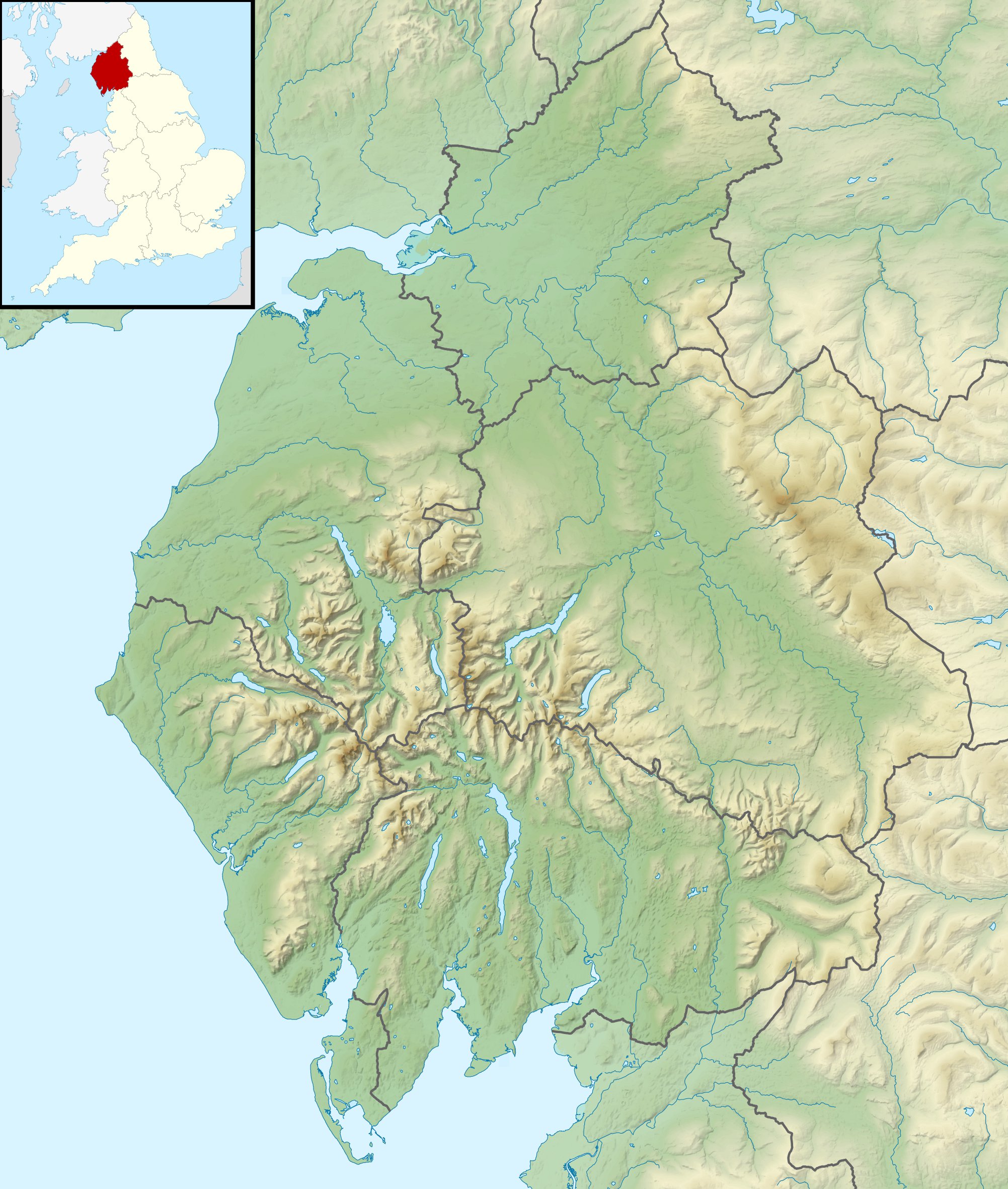
Relief map of Cumbria, UK. Equirectangular map projection on WGS 84 datum, with N/S stretched 170% Geographic limits:
|
| تاريخ | |
| مصدر |
|
| مؤلف | Nilfanion, created using Ordnance Survey data |
| سماح (إعادة استخدام الملف ده) |
الملف ده مترخص حسب رخصة المشاع الإبداعى نسبة المصنف للى مألفه - المشاركة بالمثل 3.0 العامه نسبه ل: Contains Ordnance Survey data © Crown copyright and database right
|
| إصدارات أخرى | File:Cumbria UK district map (blank).svg - Blank map |
.svg)
تاريخ الفايل
اضغط على الساعه/التاريخ علشان تشوف الفايل زى ما كان فى الوقت ده.
| الساعه / التاريخ | صورة صغيرة | ابعاد | يوزر | تعليق | |
|---|---|---|---|---|---|
| دلوقتي | 01:24، 29 نوفمبر 2011 | | 2,003 × 2,363 (700 كيلوبايت) | Nilfanion | {{Information |Description=Relief map of Cumbria, UK. Equirectangular map projection on WGS 84 datum, with N/S stretched 170% Geographic limits: *West: 3.80W *East: 2.10W *North: 55.20N *South: 54.02N |Source=[[w:Ordnance Survey|Ordnance S |
استخدام الفايل
ال1 صفحة دى فيها وصله للفايل ده:
استخدام الملف العام
الويكيات التانيه دى بتستخدم الفايل ده:
- الاستخدام ف ar.wikipedia.org
- الاستخدام ف bg.wikipedia.org
- الاستخدام ف ca.wikipedia.org
- الاستخدام ف ceb.wikipedia.org
- الاستخدام ف en.wikipedia.org
- River Derwent, Cumbria
- Morecambe Bay
- Cross Fell
- River Leven, Cumbria
- River Esk, Cumbria
- River Cocker, Cumbria
- Firbank Fell
- Green Hill (Lancashire)
- Haweswater Beck
- River Mite
- Thurstonfield Lough
- River Greta, Cumbria
- Rusland Pool
- River Glenderamackin
- River Bela
- Peasey Beck
- Stainton Beck
- River Ellen
- Kershope Burn
- River Caldew
- River Petteril
- River Dee, Cumbria
- Clough River
- Solway Aviation Museum
- Black Fell (Pennines)
- Seathwaite Tarn
- Appleby Fells
- Murton Fell
- Moss Eccles Tarn
- Little Langdale
- Wikipedia talk:UK Wikipedians' notice board/Archive 15
- Killhope Cross
- Template:Infobox mountain pass/testcases
- Alcock Tarn
- Roe Beck
- Cam Beck
- Module:Location map/data/United Kingdom Cumbria
- Module:Location map/data/Cumbria
- Module:Location map/data/United Kingdom Cumbria/doc
اعرض استخدام عام اكتر للملف ده.