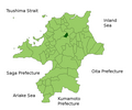
ملف:Kotake in Fukuoka Prefecture.png

حجم البروفه دى: 719 × 599 بكسل. الأبعاد التانيه: 288 × 240 بكسل | 576 × 480 بكسل | 922 × 768 بكسل | 1,081 × 901 بكسل.
الصوره الاصليه (1,081 × 901 بكسل حجم الفايل: 42 كيلوبايت، نوع MIME: image/png)
تاريخ الفايل
اضغط على الساعه/التاريخ علشان تشوف الفايل زى ما كان فى الوقت ده.
| الساعه / التاريخ | صورة صغيرة | ابعاد | يوزر | تعليق | |
|---|---|---|---|---|---|
| دلوقتي | 14:21، 5 فبراير 2010 |  | 1,081 × 901 (42 كيلوبايت) | Alberth2 | Kurogi Town, Tachibana Town, Hoshino Village, and Yabe Village were merged into Yame City. |
| 09:03، 16 يناير 2010 |  | 1,081 × 901 (42 كيلوبايت) | Alberth2 | Maebaru city, Shima town and Nijo town were merged to Itoshima City. | |
| 04:51، 12 مايو 2009 |  | 1,081 × 901 (42 كيلوبايت) | Alberth2 | == Summary == {{Information |Description=Location Map of Kotake in Fukuoka Prefecture, Japan |Source=File:FukuokaMapCurrent.png and rework |Date=May. 12th, 2009 |Author=user:alberth2 |Permission=PD |other_versions= }} == Licensing == {{PD-self}} |
استخدام الفايل
ال1 صفحة دى فيها وصله للفايل ده: