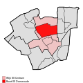
ملف:Map - NL - Dantumadeel - Wijk 00 Centrum - Buurt 00 Damwoude.svg

حجم معاينة PNG لذلك الملف ذي الامتداد SVG: 375 × 375 بكسل. الأبعاد التانيه: 240 × 240 بكسل | 480 × 480 بكسل | 768 × 768 بكسل | 1,024 × 1,024 بكسل | 2,048 × 2,048 بكسل.
الصوره الاصليه (ملف SVG، اساسا 375 × 375 بكسل، حجم الملف: 23 كيلوبايت)
تاريخ الفايل
اضغط على الساعه/التاريخ علشان تشوف الفايل زى ما كان فى الوقت ده.
| الساعه / التاريخ | صورة صغيرة | ابعاد | يوزر | تعليق | |
|---|---|---|---|---|---|
| دلوقتي | 22:07، 18 ابريل 2009 |  | 375 × 375 (23 كيلوبايت) | Michiel1972 | {{Information |Description=<!--correct utf8, ALSO show buurt boundaries outside the "wijk" of the shown "buurt" --> |Source=own work, using free avaliable sources |Date= |Author=Michiel1972, {{Attribution|nolink=[http://www.cbs.nl Centraal Bureau voor de |
| 18:49، 18 ابريل 2009 |  | 375 × 375 (16 كيلوبايت) | Michiel1972 | {{Information |Description=<!--correct utf8, corrected /removed buurt boundaries outside the "wijk" of the shown "buurt" --> |Source=own work, using free avaliable sources |Date= |Author=Michiel1972, {{Attribution|nolink=[http://www.cbs.nl Centraal Burea | |
| 21:01، 19 مارس 2009 |  | 375 × 375 (16 كيلوبايت) | Michiel1972 | {{Information |Description=*{{subst:PAGENAME}} *locator map showing municipality boundary (2009) and statistical district/neighbourhood boundaries according to CBS *Numbering and names of neighboorhoods as defined by CBS in the 2008 Esri publication brt_2 |
استخدام الفايل
ال1 صفحة دى فيها وصله للفايل ده:
استخدام الملف العام
الويكيات التانيه دى بتستخدم الفايل ده:
- الاستخدام ف ar.wikipedia.org
- الاستخدام ف ceb.wikipedia.org
- الاستخدام ف nl.wikipedia.org
- الاستخدام ف www.wikidata.org
- الاستخدام ف zh-min-nan.wikipedia.org
