ملف:Middle America relief location map.png
حجم البروفه دى: 800 × 538 بكسل. الأبعاد التانيه: 320 × 215 بكسل | 640 × 430 بكسل | 1,024 × 688 بكسل | 1,280 × 860 بكسل | 2,000 × 1,344 بكسل.
الصوره الاصليه (2,000 × 1,344 بكسل حجم الفايل: 3.56 ميجابايت، نوع MIME: image/png)
الخلاصة
| وصف |
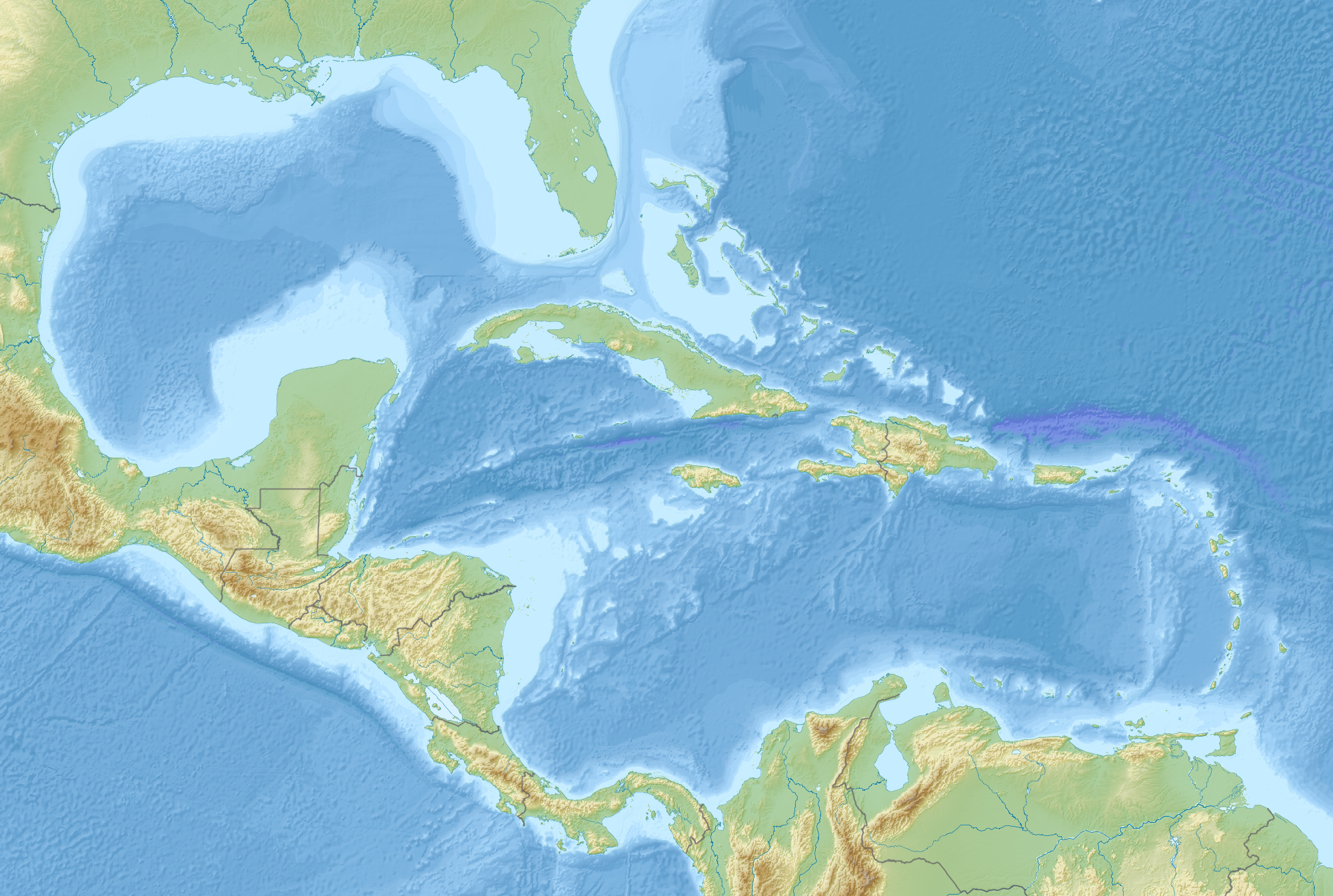
English: Map of Middle America, including the Gulf of Mexico and the Caribbean Sea, with the addition of national borders.
Equirectangular projection. Strechted by 106.0%. Geographic limits of the map:
Relief: ETOPO1. Coastline, borders, rivers etc: Made with Natural Earth. Free vector and raster map data @ naturalearthdata.com. |
| تاريخ | |
| مصدر | عمل شخصى |
| مؤلف | Uwe Dedering |
الترخيص
أنا، صاحب حقوق التأليف والنشر لهذا العمل، أنشر هذا العمل تحت الرخصة التالية:
الملف ده مترخص حسب رخصة المشاع الإبداعى نسبة المصنف للى مألفه - المشاركة بالمثل 3.0 العامه
- إنت حر:
- فى المشاركه – علشان نسخ و توزيع و بث العمل
- إنك تمزج – فى تكييف العمل
- بالشروط دى:
- نسبه ل – لازم يتنسب العمل للى مألفه بشكل مناسب و توفير رابط للرخصه وتحديد اذا حصلت تغييرات. ممكن ده يتعمل بأى طريقه معقوله، لكن مش بطريقه تشير ان مانح الرخصه بيوافقك على الاستعمال.
- مشاركه زي – لو عدت إنتاج المواد أو غيرت فيها، لازم تنشر مساهماتك اللى جايه من الأصل تحت ترخيص الأصل نفسه أو تحت ترخيص متوافق معاه.
تاريخ الفايل
اضغط على الساعه/التاريخ علشان تشوف الفايل زى ما كان فى الوقت ده.
| الساعه / التاريخ | صورة صغيرة | ابعاد | يوزر | تعليق | |
|---|---|---|---|---|---|
| دلوقتي | 09:14، 19 اغسطس 2010 | | 2,000 × 1,344 (3.56 ميجابايت) | Uwe Dedering | {{Information |Description={{en|1=Map of Middle America, including the Gulf of Mexico and the Carribean Sea. Equirectangular projection. Strechted by 106.0%. Geographic limits of the map: * N: 32.0° N * S: 6.0° N * W: 99.0° W * E: 58.0° W Relief: [ |
استخدام الفايل
مافيش صفحات بتوصل للفايل ده.
استخدام الملف العام
الويكيات التانيه دى بتستخدم الفايل ده:
- الاستخدام ف ar.wikipedia.org
- الاستخدام ف az.wikipedia.org
- الاستخدام ف ba.wikipedia.org
- الاستخدام ف ceb.wikipedia.org
- الاستخدام ف ce.wikipedia.org
- الاستخدام ف de.wikipedia.org
- الاستخدام ف en.wikipedia.org
- 2006 Gulf of Mexico earthquake
- American Mediterranean Sea
- Module:Location map/data/Middle America/doc
- San Esteban (1554 shipwreck)
- 2004 Les Saintes earthquake
- 1843 Guadeloupe earthquake
- Module:Location map/data/Middle America
- 1867 Virgin Islands earthquake and tsunami
- 1839 Martinique earthquake
- Maya Block
- Yucatán Platform
- الاستخدام ف es.wikipedia.org
- الاستخدام ف et.wikipedia.org
- الاستخدام ف fr.wikipedia.org
اعرض استخدام عام اكتر للملف ده.