ملف:Morocco (west africa orthographic projection).svg

حجم معاينة PNG لذلك الملف ذي الامتداد SVG: 550 × 550 بكسل. الأبعاد التانيه: 240 × 240 بكسل | 480 × 480 بكسل | 768 × 768 بكسل | 1,024 × 1,024 بكسل | 2,048 × 2,048 بكسل.
الصوره الاصليه (ملف SVG، اساسا 550 × 550 بكسل، حجم الملف: 373 كيلوبايت)
.svg)
| وصف |
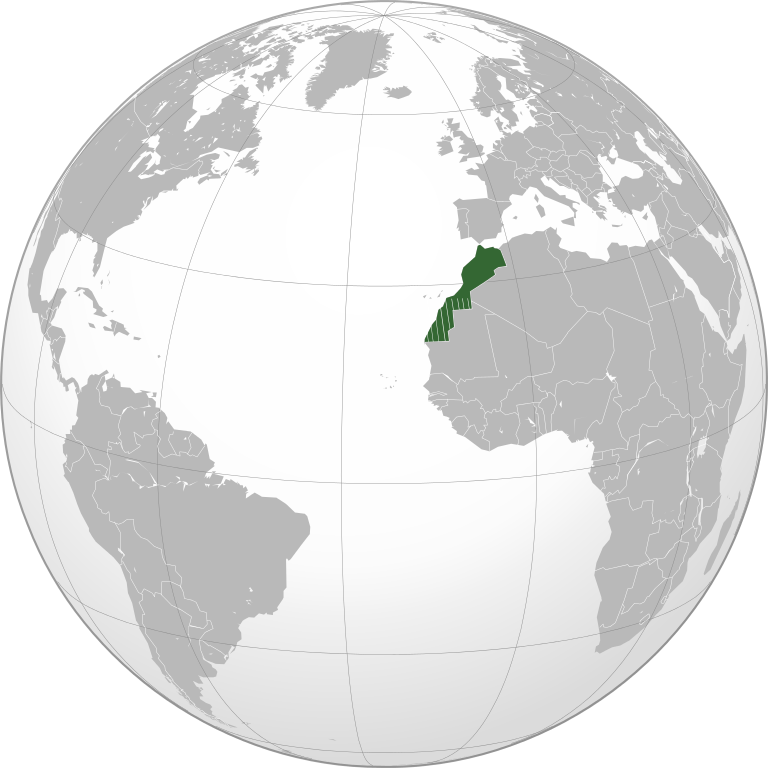
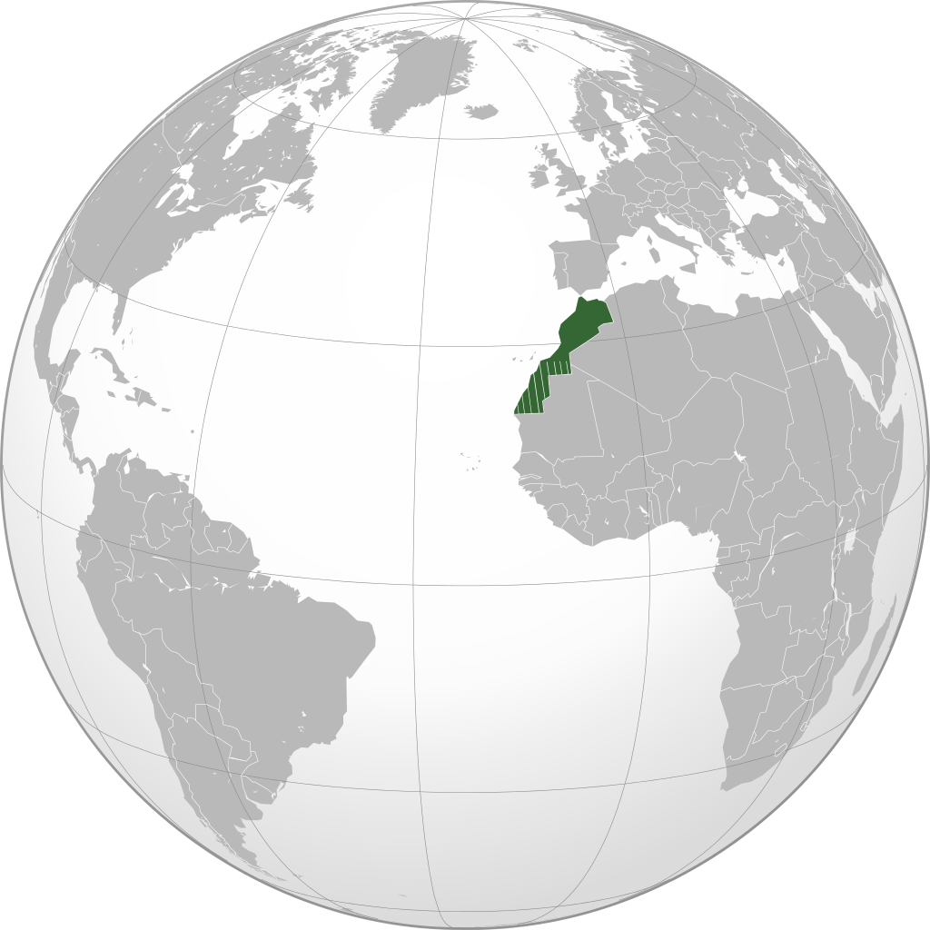
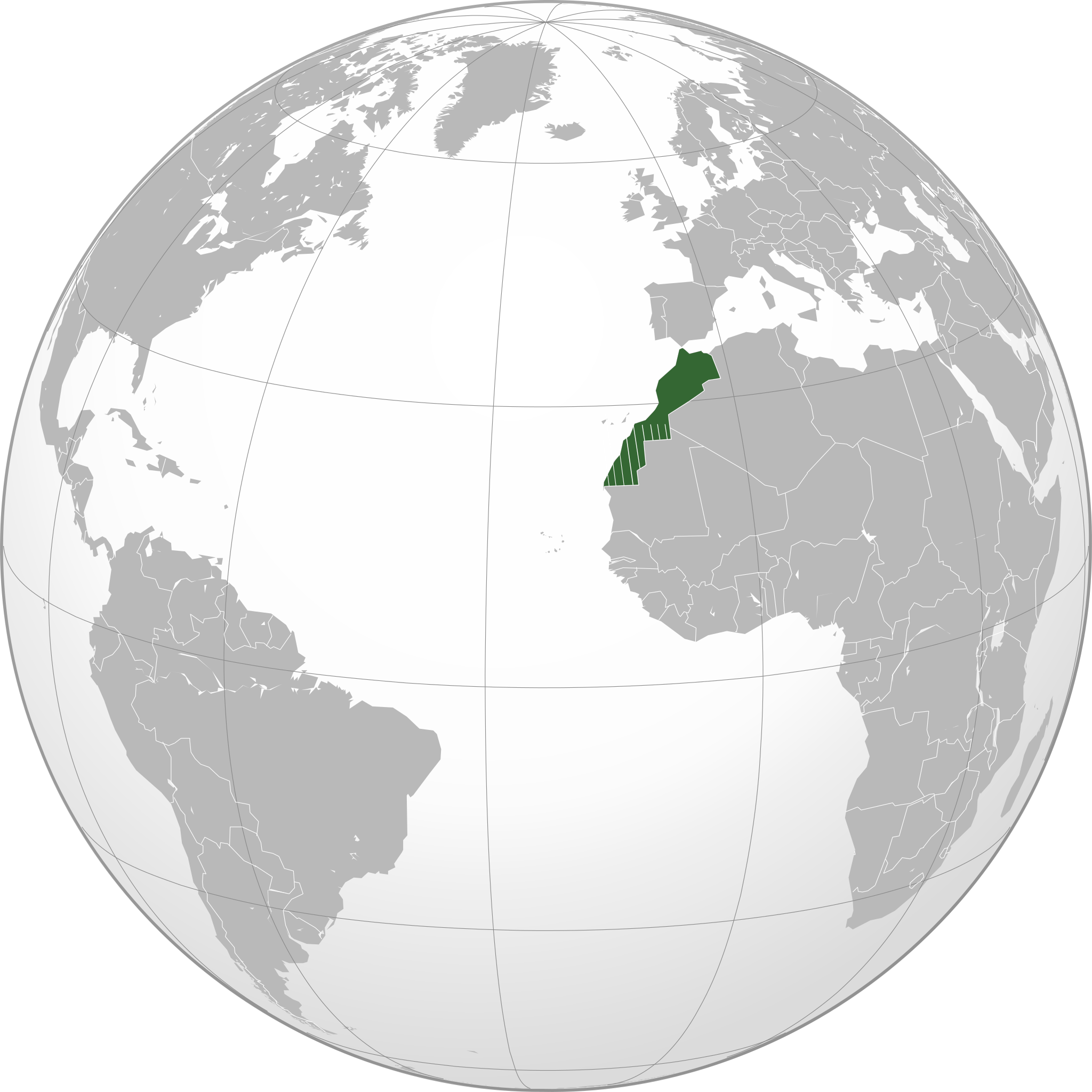
English: Locator of Morocco and its disputed territory Western Sahara shown as striped (West Africa orthographic projection). United Nations recognize Morocco as an administrative power of the territory. Report of the Secretary-General of the United Nations |
| تاريخ | |
| مصدر | عمل شخصى |
| مؤلف | Flad |
The map has been created with the Generic Mapping Tools: https://www.generic-mapping-tools.org/ using one or more of these public-domain datasets for the relief:
|

|
يسمح بنسخ و توزيع و / أو تعديل الوثيقه دى تحت شروط رخصة جنو للوثائق الحره، الإصدار 1.2 أو أى إصدار تنشره مؤسسة البرمجيات الحره؛ بدون أقسام ثابته و بدون نصوص أغلفه أماميه و بدون نصوص أغلفه خلفيه. نسخه من الرخصه متضمنه ف قسم اسمه GNU Free Documentation License. |
تاريخ الفايل
اضغط على الساعه/التاريخ علشان تشوف الفايل زى ما كان فى الوقت ده.
| الساعه / التاريخ | صورة صغيرة | ابعاد | يوزر | تعليق | |
|---|---|---|---|---|---|
| دلوقتي | 16:01، 20 نوفمبر 2010 | | 550 × 550 (373 كيلوبايت) | Flad | {{Information |Description={{en|1=Locator of Morocco and its disputed territory Western Sahara shown as striped (West Africa orthographic projection). United Nations recognize Morocco as an administrative power of the territory. [http://www.un.org/documen |
| 15:36، 20 نوفمبر 2010 |  | 550 × 550 (364 كيلوبايت) | Flad | {{Information |Description={{en|1=Locator of Morocco and its disputed territory Western Sahara shown as striped (West Africa orthographic projection). United Nations recognize Morocco as an administrative power of the territory. [http://www.un.org/documen |
استخدام الفايل
ال1 صفحة دى فيها وصله للفايل ده:
استخدام الملف العام
الويكيات التانيه دى بتستخدم الفايل ده:
- الاستخدام ف ar.wikipedia.org
- الاستخدام ف incubator.wikimedia.org
- الاستخدام ف zgh.wikipedia.org
.svg)