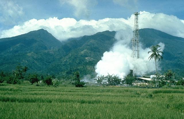
ملف:Mount Malinao.jpg
Mount_Malinao.jpg (640 × 416 بكسل حجم الفايل: 43 كيلوبايت، نوع MIME: image/jpeg)
تاريخ الفايل
اضغط على الساعه/التاريخ علشان تشوف الفايل زى ما كان فى الوقت ده.
| الساعه / التاريخ | صورة صغيرة | ابعاد | يوزر | تعليق | |
|---|---|---|---|---|---|
| دلوقتي | 18:00، 11 اكتوبر 2010 |  | 640 × 416 (43 كيلوبايت) | Michael Metzger | {{Information |Description=Mount Malinao is a forested stratovolcano with a summit crater that is breached to the east. The Tiwi geothermal field, seen here with the volcano in the background, is located on the east flanks of Malinao. The geothermal field |
استخدام الفايل
ال1 صفحة دى فيها وصله للفايل ده:
استخدام الملف العام
الويكيات التانيه دى بتستخدم الفايل ده:
- الاستخدام ف bcl.wikipedia.org
- الاستخدام ف cs.wikipedia.org
- الاستخدام ف de.wikipedia.org
- الاستخدام ف en.wikipedia.org
- الاستخدام ف fa.wikipedia.org
- الاستخدام ف fr.wikipedia.org
- الاستخدام ف ilo.wikipedia.org
- الاستخدام ف lld.wikipedia.org
- الاستخدام ف nl.wikipedia.org
- الاستخدام ف www.wikidata.org

