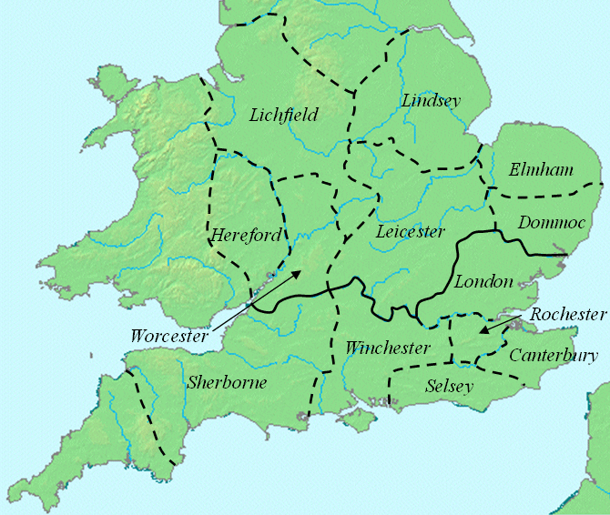
ملف:Offa dioceses.gif
Offa_dioceses.gif (670 × 566 بكسل حجم الفايل: 174 كيلوبايت، نوع MIME: image/gif)
تاريخ الفايل
اضغط على الساعه/التاريخ علشان تشوف الفايل زى ما كان فى الوقت ده.
| الساعه / التاريخ | صورة صغيرة | ابعاد | يوزر | تعليق | |
|---|---|---|---|---|---|
| دلوقتي | 14:31، 8 مارس 2008 |  | 670 × 566 (174 كيلوبايت) | Cæruleum | {{Information |Description=This map shows dioceses in England during the reign of Offa. The boundary between the archdioceses of Lichfield and Canterbury is shown in bold. This file was created using [http://www.demis.nl/home/pages/home.htm DMIS]. On t |
استخدام الفايل
ال1 صفحة دى فيها وصله للفايل ده:
استخدام الملف العام
الويكيات التانيه دى بتستخدم الفايل ده:
- الاستخدام ف azb.wikipedia.org
- الاستخدام ف ca.wikipedia.org
- الاستخدام ف de.wikipedia.org
- الاستخدام ف el.wikipedia.org
- الاستخدام ف en.wikipedia.org
- الاستخدام ف es.wikipedia.org
- الاستخدام ف fi.wikipedia.org
- الاستخدام ف gl.wikipedia.org
- الاستخدام ف id.wikipedia.org
- الاستخدام ف ja.wikipedia.org
- الاستخدام ف pl.wikipedia.org
- الاستخدام ف pt.wikipedia.org
- الاستخدام ف ru.wikipedia.org
- الاستخدام ف sv.wikipedia.org
