ملف:Pinus ponderosa subspecies range map.png
حجم البروفه دى: 489 × 599 بكسل. البعدان التانيين: 196 × 240 بكسل | 609 × 746 بكسل.
الصوره الاصليه (609 × 746 بكسل حجم الفايل: 77 كيلوبايت، نوع MIME: image/png)
| وصف |
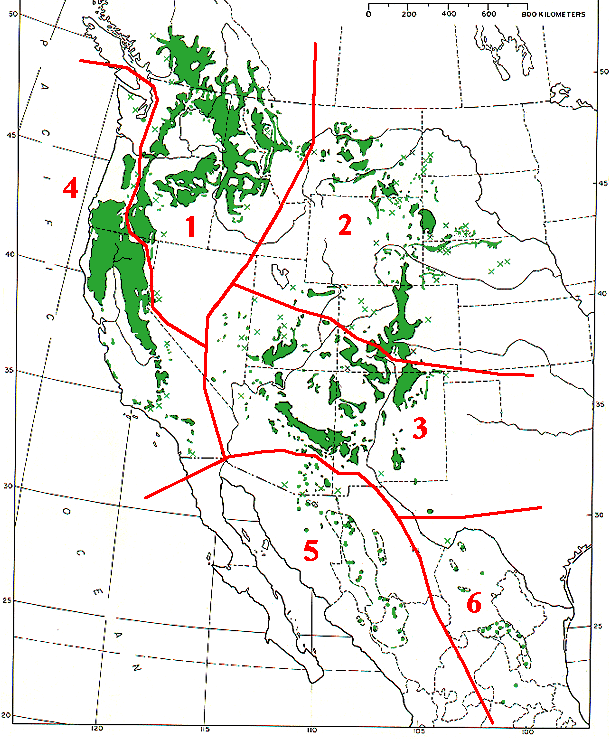
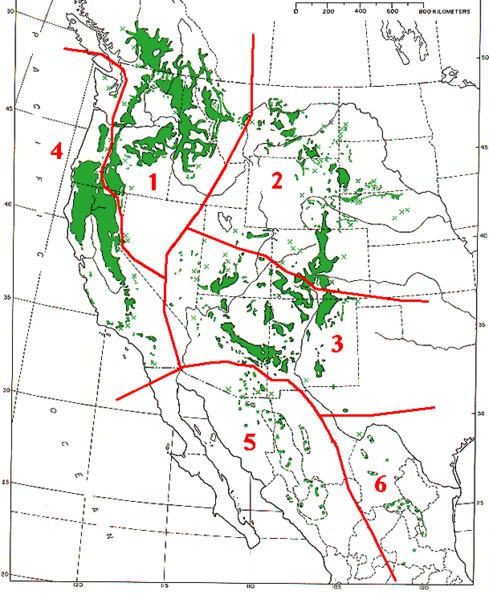
Range map of Pinus ponderosa and Pinus arizonica
|
|||
| تاريخ | ||||
| مصدر | Base map (black outlines & green range map) is from USDA Forest Service Misc,.Publ. 991 (public domain-USGov); red delineation is my work, which I release into public domain | |||
| مؤلف | MPF | |||
| سماح (إعادة استخدام الملف ده) |
|
تاريخ الفايل
اضغط على الساعه/التاريخ علشان تشوف الفايل زى ما كان فى الوقت ده.
| الساعه / التاريخ | صورة صغيرة | ابعاد | يوزر | تعليق | |
|---|---|---|---|---|---|
| دلوقتي | 14:09، 7 ديسمبر 2009 | | 609 × 746 (77 كيلوبايت) | MPF | {{Information |Description=Range map of ''Pinus ponderosa'' and ''Pinus arizonica'' # ''Pinus ponderosa'' subsp. ''ponderosa'' - North Plateau Ponderosa Pine # ''Pinus ponderosa'' subsp. ''scopulorum'' - Rocky Mts Ponderosa Pine # ''Pinus ponderos |
استخدام الفايل
ال1 صفحة دى فيها وصله للفايل ده:
استخدام الملف العام
الويكيات التانيه دى بتستخدم الفايل ده:
- الاستخدام ف ca.wikipedia.org
- الاستخدام ف cs.wikipedia.org
- الاستخدام ف el.wikipedia.org
- الاستخدام ف es.wikipedia.org
- الاستخدام ف id.wikipedia.org
- الاستخدام ف nl.wikipedia.org
- الاستخدام ف pl.wikipedia.org
- الاستخدام ف pt.wikipedia.org
- الاستخدام ف sv.wikipedia.org
- الاستخدام ف tr.wikipedia.org
- الاستخدام ف uk.wikipedia.org
- الاستخدام ف www.wikidata.org