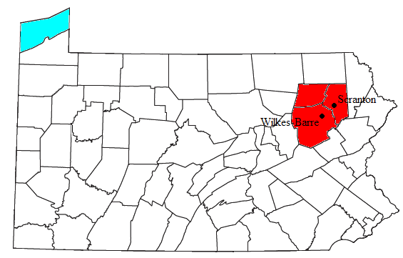
ملف:Scranton-Wilkes-Barre Metropolitan Area.png
Scranton-Wilkes-Barre_Metropolitan_Area.png (565 × 361 بكسل حجم الفايل: 28 كيلوبايت، نوع MIME: image/png)
تاريخ الفايل
اضغط على الساعه/التاريخ علشان تشوف الفايل زى ما كان فى الوقت ده.
| الساعه / التاريخ | صورة صغيرة | ابعاد | يوزر | تعليق | |
|---|---|---|---|---|---|
| دلوقتي | 05:01، 10 فبراير 2010 |  | 565 × 361 (28 كيلوبايت) | Yassie | added locations of cities of Scranton and Wilkes-Barre |
| 19:32، 30 يوليه 2008 |  | 565 × 361 (27 كيلوبايت) | Nyttend | {{Information |Description=Locator map of the {{w|Wyoming Valley|Scranton-Wilkes-Barre Metropolitan Statistical Area}} in the northeastern part of the {{w|U.S. state}} of {{w|Pennsylvania}}. |Source=Modified from [http://www2.census.gov/geo/maps/general_r |
استخدام الفايل
ال1 صفحة دى فيها وصله للفايل ده:
استخدام الملف العام
الويكيات التانيه دى بتستخدم الفايل ده:
- الاستخدام ف en.wikipedia.org
- الاستخدام ف es.wikipedia.org
- الاستخدام ف ja.wikipedia.org
- الاستخدام ف sv.wikipedia.org
- الاستخدام ف ur.wikipedia.org
- الاستخدام ف www.wikidata.org
