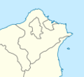
ملف:Taipei County Location Map.png
Taipei_County_Location_Map.png (417 × 549 بكسل حجم الفايل: 35 كيلوبايت، نوع MIME: image/png)
تاريخ الفايل
اضغط على الساعه/التاريخ علشان تشوف الفايل زى ما كان فى الوقت ده.
| الساعه / التاريخ | صورة صغيرة | ابعاد | يوزر | تعليق | |
|---|---|---|---|---|---|
| دلوقتي | 23:09، 28 فبراير 2009 |  | 417 × 549 (35 كيلوبايت) | Esun | Reverted to version as of 03:10, 26 October 2006 |
| 21:57، 28 فبراير 2009 |  | 123 × 112 (5 كيلوبايت) | Esun | A location map is used for mark a specific location within the map using coordinates. Previous image is the location of Taipei county in Taiwan map. It should be named something else, such as Taipei_County_in_Taiwan_Map. | |
| 03:10، 26 اكتوبر 2006 |  | 417 × 549 (35 كيلوبايت) | Taiwan Junior | {{Information |Description=Location of Taipei County in Taiwan |Source=Self-made |Date=2006.10.26 |Author=Taiwan Junior |Permission= |other_versions= }} |
استخدام الفايل
ال1 صفحة دى فيها وصله للفايل ده:
استخدام الملف العام
الويكيات التانيه دى بتستخدم الفايل ده:
- الاستخدام ف en.wikipedia.org
- الاستخدام ف es.wikipedia.org
- الاستخدام ف ja.wikipedia.org
- الاستخدام ف mt.wikipedia.org
- الاستخدام ف www.wikidata.org
- الاستخدام ف zh-min-nan.wiktionary.org
- الاستخدام ف zh.wikipedia.org

